The Writer’s Guide to Maritime Navigation

Over the last couple of weeks, I have covered different ships and a large span of maritime history. However, all these ships mean nothing if you do not know how to get where you are going. Today I will cover maritime navigation. I will mainly focus on navigation before satellite and radio.
As always, magic is the exception to the rule. Because magic.
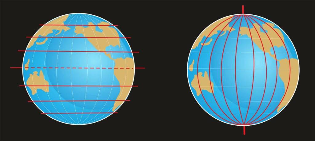
Latitude and Longitude
Latitude is the distance north to south around the globe and is depicted as horizontal lines on maps of the Earth. It is usually expressed in degrees with the equator being 0 degrees. Mariners calculated latitude in the northern hemisphere by sighting the sun, moon, or north star with a sextant.
Longitude, the vertical lines on your map, dictate east-to-west distances from the prime meridian or Greenwich meridian. Longitude is also expressed in degrees ranging from 0 to 180 degrees east to west. Longitude is much harder to calculate than latitude because you must know the exact time that you are from Greenwich mean time. This requires hyper accurate timepieces which were not available until the late 18th century and not affordable until the 19th century.
Coastal Navigation
Our earliest seafaring ancestors followed the coast. With the shoreline in sight, it was harder to get lost than venturing out into open waters.
Dead Reckoning
Early mariners navigated by using landmarks, memory, observation, and information passed down by others. A variation of this type of navigation is known as dead reckoning. A ship captain would point his vessel in the direction that he wished to go and try to hold a straight line. He would estimate his location given the speed of the ship. This is not the best navigation method because any steering error can take the vessel wildly off course.
Celestial Navigation
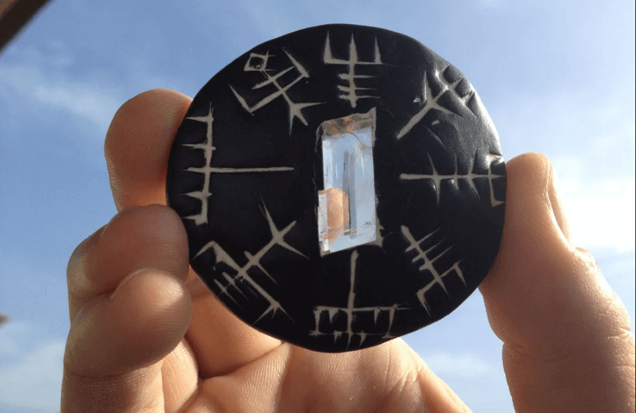
Celestial navigation is based on the observation of the sun, moon, and stars. Sailors would use the sun to set an east or west heading. The North Star was used heavily by early mariners at night. Ancient Vikings are rumored to use a special type of crystal known as a sunstone to locate the sun even on a cloudy day and then utilize a primitive compass known as a sunboard to set their heading. If you are interested in learning more there was a fantastic episode of Expedition Unknown that covers this topic.
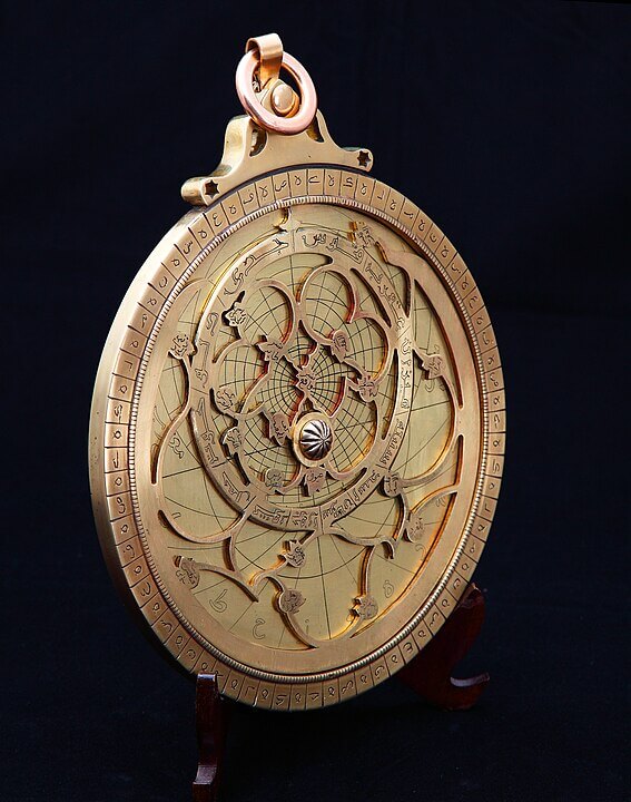
Astrolabe
An astrolabe is an instrument that serves as a star chart and a physical model of visible heavenly bodies. It is usually a metal disc with a pattern of wire cut outs and perforations that allow the user to accurately calculate astronomical positions. It can measure the altitude above the horizon of a celestial body and can identify stars or planets to determine latitude. Although it is less reliable in rough seas. The astrolabe was used widely during the Islamic Golden Age.
Compasses
The compass uses a magnetized needle to determine magnetic north. They also show angles in degrees with N corresponding to 0 degrees. This allows the compass to show bearings in degrees. The Han Chinese developed the first compass using lodestones. [1] The earliest representation of a compass used aboard ship was from an illustration dating to 1403.
Sextant
The sextant is an instrument that measures the altitude of an object. The sextant measures the angle and time, which can calculate the latitude. I will go into further detail in my next blog post.
I hope this was helpful. Let me know if you have questions or suggestions by using the Contact Me form on my website or by writing a comment. I post every Friday and would be grateful if you would share my content.
If you want my blog delivered straight to your inbox every month along with exclusive content and giveaways, please sign up for my email list here.
May you always find the right words.
Copyright © 2023 Rebecca Shedd. All rights reserved.
[1] Lowrie, William (2007). Fundamentals of Geophysics. London: Cambridge University Press. pp. 281. ISBN 978-0-521-67596-3. Early in the Han Dynasty, between 300–200 BC, the Chinese fashioned a rudimentary compass out of lodestone ... the compass may have been used in the search for gems and the selection of sites for houses ... their directive power led to the use of compasses for navigation

.jpg)